What do you know about the Idaho-Maryland Mine?
Did you know that the Idaho-Maryland Mine is one of the oldest mines in our region, and previous companies have attempted to re-start operations before? The mine known as “Idaho-Maryland Mine” is an old consolidated gold mine that has not operated since 1956, located in Grass Valley. In the last 20 years, three different companies have attempted to make the mine operational again. This most recent attempt is by Rise Gold Corporation, who bought the mineral rights in 2018 from EmGold Mining and began exploratory drilling shortly thereafter. For a more detailed history of mine operations, check out Ralph Silberstein’s Union Op Ed and Rise Gold Corp’s History of Idaho-Maryland Mine website.

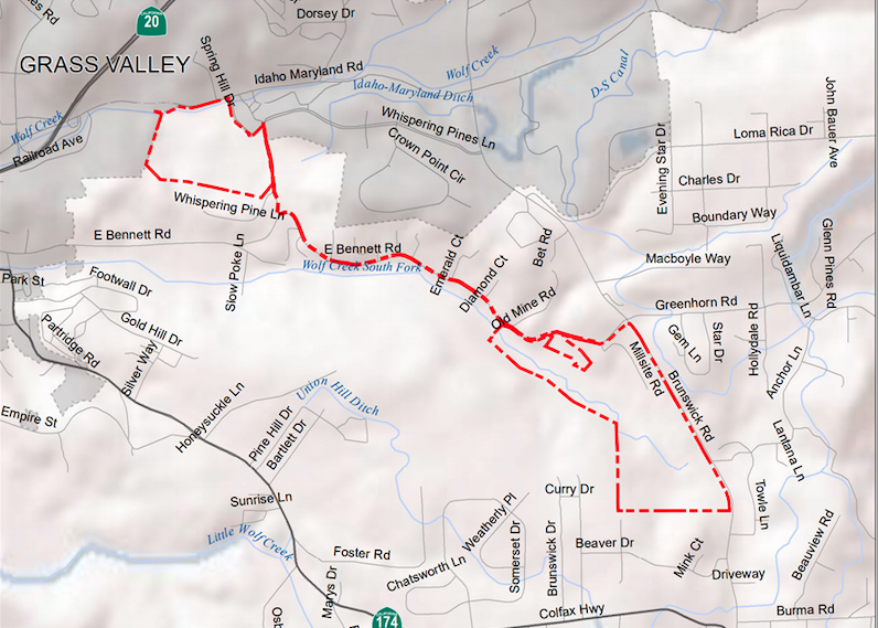
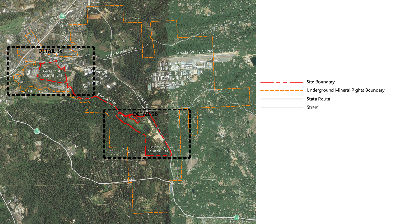
The Idaho-Maryland Mine encompasses two different project sites, the Brunswick Industrial Site and the Centennial Industrial Site. Together, the two sites total approximately 175.34 acres on the surface, and approximately 2,585 subsurface acres through acquisition of mineral rights. Additionally, the project requires off-site improvements that include a potable water pipeline that would be installed by Nevada Irrigation District and located along East Bennet Road. 1
Nevada County’s Notice of Preparation (NOP) states that “[t]he proposed project would reinitiate underground mining and gold mineralization processing for the Idaho-Maryland Mine over an 80-year permit period with gold mineralization processing and underground exploration / mining proposed to operate 24 hours a day, 7 days a week during full operations.”
On August 17, 2020, Nevada County closed its comment period for the NOP to the public to learn of all potential environmental impacts to re-open the Idaho-Maryland mine. Thank you to all SYRCL members and supporters who submitted initial scoping comments, especially given the short comment window amidst the COVID-19 pandemic and the Jones Fire.
SYRCL is watchdogging the project due to negative mining impacts within the Yuba and Bear River watersheds from past operations. Therefore, SYRCL also submitted comments to the County articulating some specific concerns about the following environmental impacts:
- Exacerbating Legacy Mining Impacts to our watersheds and community,
- Indirectly and directly harming local water quality and water supply, including but not limited to Wolf Creek, Bear River, and precious groundwater resources,
- Exacerbating impacts of the climate crisis, and
- Causing serious fiscal and aesthetic harm to our community.
Overall, SYRCL requested that the County’s Draft Environmental Impact Report (DEIR) be thorough and protective of our community and the Yuba and Bear River watersheds. Read SYRCL’s comments below, and visit the Community Environmental Advocates Foundation website to see additional informative comments on the Mine.
Robust public engagement is vital to truly assess the environmental impacts to our community and our precious waterways. SYRCL will provide updates once the DEIR is released. In the meantime, learn more about the project by visiting the Community Environmental Advocates Foundation website and check out their Frequently Asked Questions.
1. See Nevada County Notice of Preparation (NOP), pg. 1.
Did you enjoy this post?
Get new SYRCL articles delivered to your inbox by subscribing to our ENews.


Please publish a map of the mineral rights boundary on a street map. This is where the blasting will take place. The project boundary is only the aboveground operation and is much smaller than the 2,500 acre project. Thank you.
Katherine Thompson, you can find that map here: https://yubariver.org/issues/idaho-maryland-mine/