Meadow Restoration

Unveiling the Van Norden Meadow Restoration Project Following a Record-Breaking Winter

Unveiling the Van Norden Meadow Restoration Project Following a Record-Breaking Winter

Following a record-breaking winter, South Yuba River Citizen League (SYRCL) scientists were eager to check in on the success of the restoration completed in 2022 during Phase 1 of the Van Norden Meadow Restoration Project!  

Monitoring for Groundwater and Surface Water in the Haskell Peak Meadows Project

Monitoring for Groundwater and Surface Water in the Haskell Peak Meadows Project

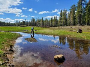
Kyle McNeil, Ecohydrologist for the South Yuba River Citizens League (SYRCL), Wrenn Cleary, SYRCL’s AmeriCorps Monitoring Coordinator, and Jessica Nguyen were recently out monitoring for groundwater and surface water at Freeman and West Church Meadows in the Haskell Peak Meadows project in the upper North Yuba headwaters area.

SYRCL was back at Loney Meadow

SYRCL was back at Loney Meadow

In July of 2023, SYRCL was back up at Loney installing fencing. Fencing at Loney and Upper Loney Meadows is done to protect stream channels, plants, or equipment from cattle activity. For the metal groundwater wells, cows can sometimes see these wells as good back-scratch posts, unfortunately damaging the pipe in the process. By putting up fencing, SYRCL can protect our monitoring sites for groundwater monitoring while cattle use the meadow too.  

Taking Streamflow Measurements at the Haskell Peak Meadows

Taking Streamflow Measurements at the Haskell Peak Meadows

Meadows are important because they are nature’s “reservoirs” that slow down and clean water in the early summer and extend the time period that the water is released. Meadow stream channels typically run dry in late summer or fall when there is no more snowmelt or groundwater to continue supplying water. Thus, there is a fairly small window of streamflow monitoring that can be as short as a few weeks up to a couple of months. 

SYRCL staff headed up to the Haskell Peak meadows in early June in order to access a couple of meadows (Freeman and West Church) to measure the amount of snowmelt running through the meadow stream channels. The timing of this effort changes every year and is dependent on the amount of snow, rainfall, air temperature, and sun exposure at the meadow, as well as staff availability to go all the way out to the North Yuba upper watershed. Ideally, we aim to monitor streamflow at the intersection of the date of peak snowmelt and there being just enough access to do the monitoring itself. This would result in capturing peak stream flow.