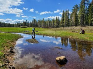
Haskell Peak Meadows Project

Restoration Project Update: The Haskell Peak Meadows

Restoration Project Update: The Haskell Peak Meadows

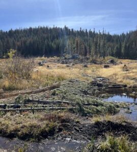
The Haskell Peak Meadows Restoration Project aims to rehabilitate the meadow hydrology in five meadows, thereby restoring ecosystem function and increasing resilience in each of these meadows to expected changes in climatic conditions. 

Meadows provide benefits that make them biodiversity and carbon sequestration hotspots, provide late season baseflows (the portion of the streamflow that is sustained between precipitation events), refugia habitat, and improve water quality and quantity for downstream users. Restoration of meadow hydrology, by re-connecting the stream channel to its natural floodplain, is the primary basis upon which other ecological values are sustained, including restoring historic riparian wet meadow, aquatic habitat, and wetland function, within the meadow system.
Monitoring for Groundwater and Surface Water in the Haskell Peak Meadows Project

Monitoring for Groundwater and Surface Water in the Haskell Peak Meadows Project

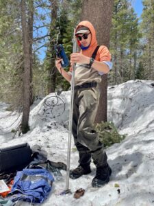
Kyle McNeil, Ecohydrologist for the South Yuba River Citizens League (SYRCL), Wrenn Cleary, SYRCL’s AmeriCorps Monitoring Coordinator, and Jessica Nguyen were recently out monitoring for groundwater and surface water at Freeman and West Church Meadows in the Haskell Peak Meadows project in the upper North Yuba headwaters area.

Taking Streamflow Measurements at the Haskell Peak Meadows

Taking Streamflow Measurements at the Haskell Peak Meadows

Meadows are important because they are nature’s “reservoirs” that slow down and clean water in the early summer and extend the time period that the water is released. Meadow stream channels typically run dry in late summer or fall when there is no more snowmelt or groundwater to continue supplying water. Thus, there is a fairly small window of streamflow monitoring that can be as short as a few weeks up to a couple of months. 

SYRCL staff headed up to the Haskell Peak meadows in early June in order to access a couple of meadows (Freeman and West Church) to measure the amount of snowmelt running through the meadow stream channels. The timing of this effort changes every year and is dependent on the amount of snow, rainfall, air temperature, and sun exposure at the meadow, as well as staff availability to go all the way out to the North Yuba upper watershed. Ideally, we aim to monitor streamflow at the intersection of the date of peak snowmelt and there being just enough access to do the monitoring itself. This would result in capturing peak stream flow.