Partner Projects
Check out the great work the Yuba Forest Network Partners are taking on across the Yuba River watershed:
Aquatic Organism Passage on the Tahoe National Forest
Trout Unlimited is working with the Tahoe National Forest to prioritize aquatic organism passage barriers for remediation. The upper Yuba system is pristine in many ways, but the many culverts and road-stream crossings create a patch-work of habitat for aquatic species that can be difficult or impossible to navigate safely.
TNF has surveyed about 150 of the approximately 700 road-stream crossings in the Forest, and we are currently doing reach-scale habitat surveys of some of the barriers that desktop analyses have indicated potentially have larger amounts of habitat above and below the structures. This work is part of a larger scale project in collaboration with TU and the USFS Region 5 to better understand AOP needs and methods for prioritization and remediation.
Forest Biomass Business Center
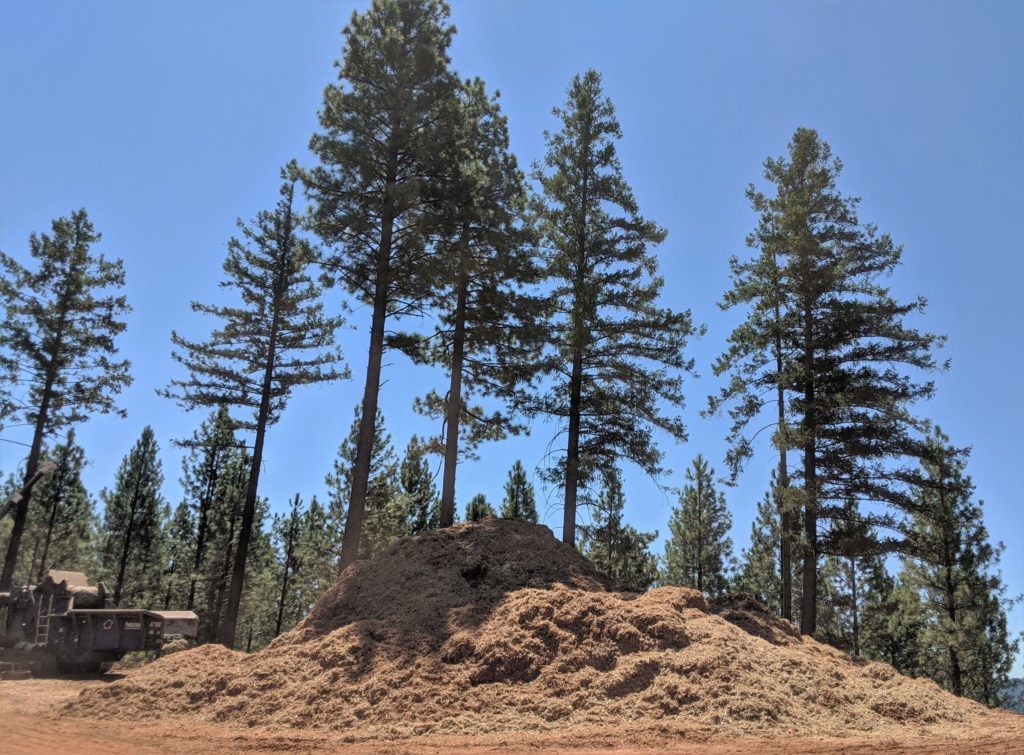
Camptonville Community Partnership (CCP), in collaboration with the Yuba Watershed Protection and Fire Safe Council, a private landowner, and the local community, is working to develop the Forest Biomass Business Center (FBBC) near Camptonville, California. The FBBC will include a 5-megawatt community scale bioenergy plant and small industrial campus, hosting enterprises that create value-added products from forest biomass.
The plant’s biomass feedstock will come from sustainable forest management activities aimed at reducing the threat of high intensity wildfires on nearby private and federal land. By creating markets for biomass and small diameter wood, which are currently underutilized, the FBBC will facilitate much-needed forest fuels reduction projects in the region, improve forest and watershed health, reduce the risk of catastrophic wildfire, and create an economic boost for local jobs and businesses.
‘Inimim Forest Restoration Project
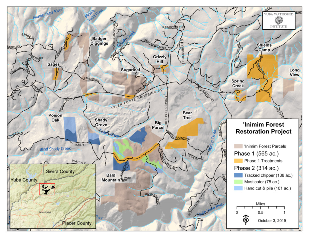
The ‘Inimim Forest is a 30-year-long land stewardship collaborative effort between the Yuba Watershed Institute (YWI) and the U.S. Bureau of Land Management (BLM) on Nevada County’s San Juan Ridge. The ‘Inimim Forest consists of ten BLM parcels totalling 2,000 acres, jointly managed by the BLM and the YWI. In recent years, the YWI has raised over $1.8 million for planning and implementation of the ‘Inimim Forest Restoration Project, with the goal of improving forest health and ecological resilience.
Phase 1 of the project involves several different treatment types, including hand cutting and piling of small-diameter woody material, hand cutting and chipping and high-priority roadways, pile burning, and hazard tree removal. Implementation of Phase 1 began in January 2020 and is currently underway. Funding for Phase 1 was provided by CAL FIRE Climate Change Investments (CCI) Fire Prevention grant program and Sierra Nevada Conservancy’s Proposition 68 grant program.
Phase 2 of the ‘Inimim Forest Restoration Project consists of about 314 acres of forest health treatments, including hand cutting and piling, hand cutting and chipping, and mechanical mastication. Implementation is scheduled to begin in November 2020. Funding for Phase 2 was provided by the Sierra Nevada Conservancy’s Proposition 68 grant program.
Little Deer Creek Landscape Resilience Project
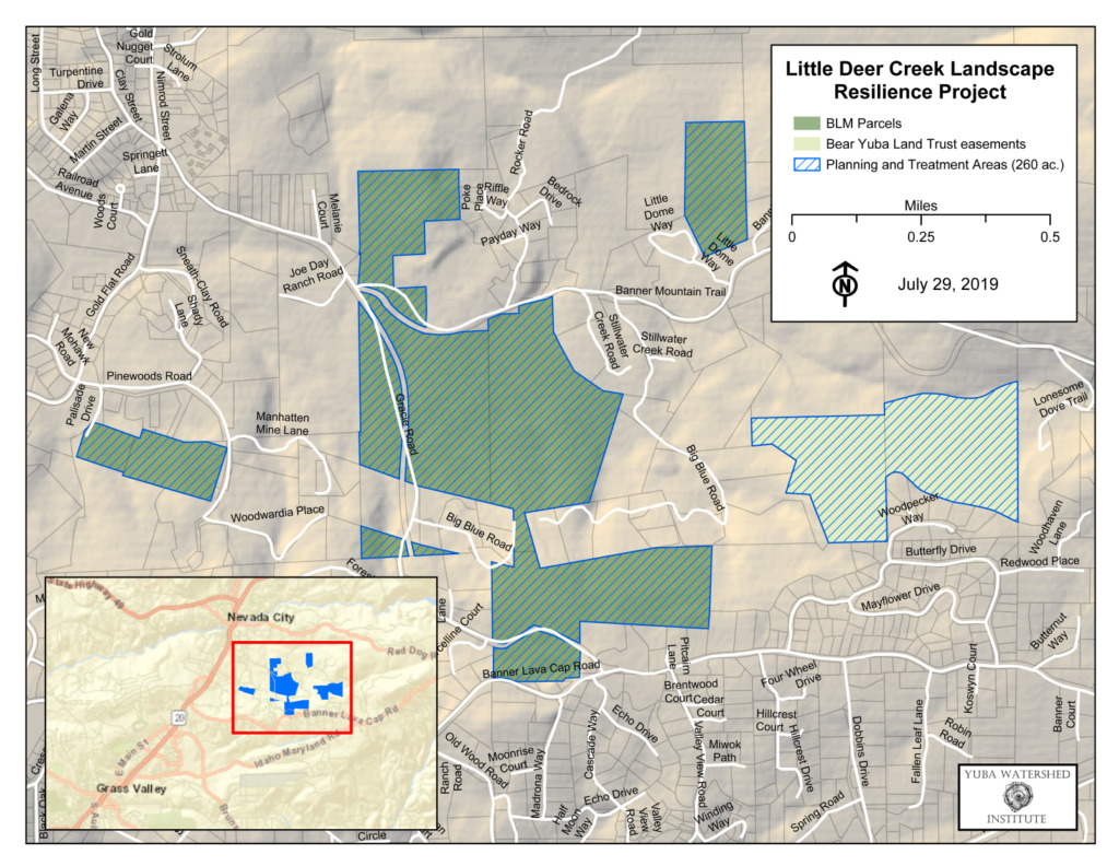
The Little Deer Creek Landscape Resilience Project is an effort to restore resilient forest structure and protect homes, recreational opportunities, and critical water infrastructure in the Little Deer Creek watershed just east of downtown Nevada City. This project is a partnership between the Yuba Watershed Institute (YWI), Sierra Streams Institute (SSI), U.S Bureau of Land Management (BLM), and the Bear Yuba Land Trust (BYLT). The project area is located about one mile east of Nevada City along Little Deer Creek, and consists of 200 acres of federal land managed by the BLM and 60 acres of private land under conservation easements held by the BYLT. Little Deer Creek flows into downtown Nevada City, where it joins Deer Creek, a major tributary of the South Yuba River.
The project site consists of heavily forested parcels among residential neighborhoods within the Wildland Urban Interface (WUI) surrounding Nevada City. The D.S. Canal, managed by Nevada Irrigation District, runs through the BLM properties. Also on BLM property is a 55-acre-foot drinking water reservoir and water treatment facility operated by Nevada City. The popular Cascade Canal Trail runs along the southern edge of the project area and connects to BYLT’s Woodpecker Wildlife Preserve. The Nevada County Sportsmen Club operates a 50-acre archery range in the project area that is used daily throughout the year. With funding from the Sierra Nevada Conservancy’s Proposition 68 grant program, the YWI is partnering with SSI to undertake project planning and environmental compliance, which should be complete by the end of 2021.
Nevada County Egress/Ingress Fire Safety Project
The Nevada County Egress/Ingress Fire Safety Project will remove hazardous vegetation along 200 miles of County-maintained roads using both County road crews and contract forces. The purpose of the project is to reduce the vegetative fuels along major roads in the County to improve the safety of residents and visitors, and to increase the effectiveness and safety of firefighters and first responders. Reduced fuels will also lead to lower fire suppression costs and fewer greenhouse gas emissions that result from wildfires. In addition, breaks in fuel continuity will aid in reducing the overall rate of spread. Egress routes will be improved which will allow residents to evacuate more quickly and allow firefighters better ingress access to prevent structure fires. For a more detailed project description, including roads that will be treated, click here.
North Yuba Forest Partnership
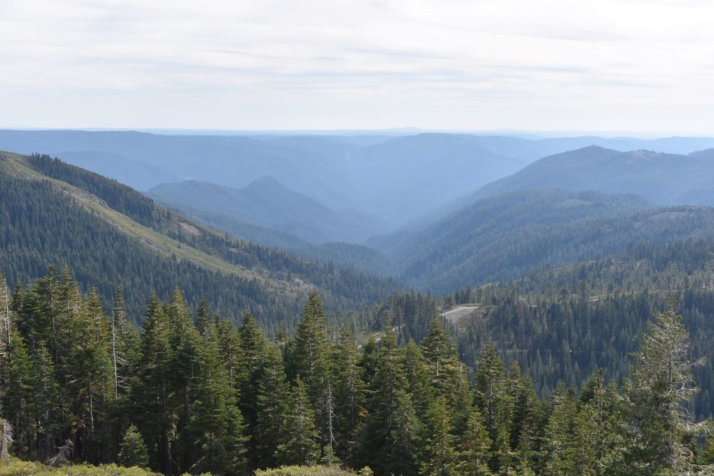
The North Yuba Forest Partnership is a diverse group of nine organizations passionate about forest health and the resilience of the North Yuba River watershed. Together, the partners are working on an unprecedented scale to collaboratively plan, analyze, finance, and implement forest restoration across 275,000 acres of the watershed.
Through ecologically-based thinning and prescribed fire, the partnership seeks to protect North Yuba communities from the threat of catastrophic wildfire and restore the watershed to a healthier, more resilient state. Restoration efforts are expected to take many years, if not decades to complete, with the most critical project areas targeted first, i.e. at-risk communities, emergency response, evacuation access routes, and treatments to areas that have the potential to stop a wildfire from spreading.
Round Mountain Landscape Resilience Project
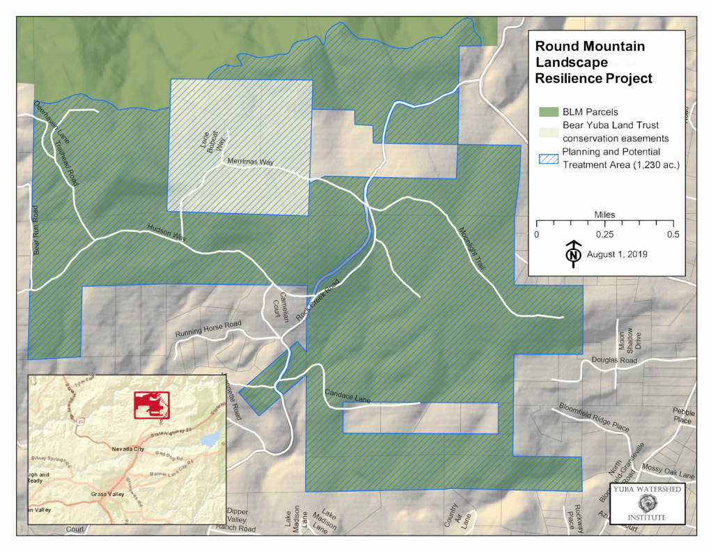
The Round Mountain Landscape Resilience Project seeks to improve forest health and resilience to wildfire, drought, and bark beetles on 1,230 acres of federal and private land in Nevada County. Round Mountain is a large area of contiguous protected public and private land located about three miles north of Nevada City on the ridge above the South Yuba River. Federal lands in the project area are managed by the U.S. Bureau of Land Management (BLM) and private lands are under conservation easements held by the Bear Yuba Land Trust (BYLT). Most of the project area is part of BLM’s South Yuba Recreation Area.
The overall landscape consists of mixed conifer, oak woodland, and open meadows. Current forest conditions are heavily overgrown and highly vulnerable to wildfire in an area of high residential population density. This is also an area of high recreational use for hiking and mountain biking. In addition, Rock Creek, a tributary to the South Yuba River, flows through the site.
The project is currently in the planning and environmental compliance phase, with funding from the Sierra Nevada Conservancy’s Proposition 68 grant program. The Yuba Watershed Institute (YWI), in partnership with the BLM, BYLT, and local residents, is creating a forest management plan for this area. In addition, the YWI will hire consultants to complete cultural and biological surveys and reports to support required environmental reviews.
South Yuba Rim Fuel Break
The South Yuba Rim Fuel Break is a landscape scale fuel break consisting of several smaller scale projects. A series of pre-fire projects have been planned to create a contiguous area of hazardous fuel reduction to effectively create a shaded fuel break from Bridgeport extending east up the San Juan Ridge to North Bloomfield.
These projects include the completed Bridgeport State Park prescribed VMP burns, the completed VMP prescribed burn at French Corral, Browning property, the completed Malakoff Diggins VMP project, and the completed Montezuma Fuel Break. This landscape scale project also includes the proposed Bunker Hill VMP, Bunker Hill Fuel Break, Shady Creek Fuel Break, Columbia Hill Fuel Break, Jackass Flat/Montezuma Ridge Fuel Break, Reader Ranch Fuel Break and the Reader Ranch/Birchville VMP.
These projects have been developed to create strategic locations where firefighting resources may more effectively attempt fire suppression activities to stop a costly and damaging fire such as the 49’er fire of 1988.
