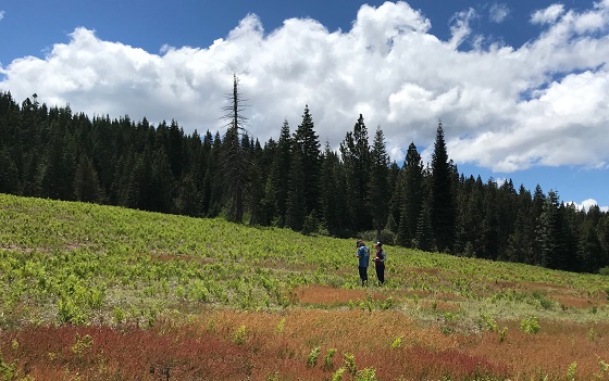
Deer Meadow

Deer Meadow is a 46-acre, high gradient meadow located near Bowman Lake in the South Yuba River watershed. The meadow has a mean elevation of 6250 feet and a gradient of approximately 7 percent. Historic land use in the area include mining, logging, grazing and their associated roads and trails. The Tahoe National Forest acquired this meadow in 1989 in a degraded condition. Sustainable grazing has continued under the current management, and the network of non-motorized trails in the watershed has been improved in recent years.
The meadow has two distinct areas, a formerly very degraded area referred to as Upper Deer Meadow and a less degraded area referred to as Lower Deer Meadow. Our restoration efforts focused on Upper Deer Meadow. Lower Deer Meadow was one of three meadows in our Loney Meadow Complex comparative experimental study. Prior to restoration efforts, topsoil had largely been lost in Upper Deer Meadow which resulted in poor vegetative cover, increased erosion, increases in GHG emissions, and decreased carbon sequestration. Additionally, old roads and ditches were diverting and concentrating water, creating gullies through the middle and lower portion of the meadow.


Upper Deer Meadow before and after restoration
Our restoration efforts in Upper Deer Meadow were completed in 2018 and focused on road and trail improvements, in addition to large revegetation efforts. To improve how the existing road network interacts with the meadow, we installed drainage features (water bars and rolling dips) and removed culverts. Skid Trails were repaired via out sloping and decompaction. In total, we revegetated 13 acres of disturbed ground with a rehabilitative mulching and seeding approach. Trail improvements were made on 6.1 miles of existing trail. SYRCL continues to do photo-point monitoring in order to track the success of restoration actions in Upper Deer Meadow.


In 2019, we completed monitoring at Lower Deer Meadow for the following attributes: groundwater, surface water, vegetation diversity, greenhouse gas flux, soil carbon, and amphibians. This data was used to compare against Loney Meadow to illuminate the potential effects that restoration efforts at Loney Meadow had on hydrology, carbon sequestration and shifts in vegetative communities. Due to the close proximity of Deer Meadow and Upper Loney Meadow to Loney Meadow, we were able use these meadows as controls in a Before After Control Impact (BACI) experimental design study. This type of study design provides us with the ability to distinguish changes associated with restoration from those that occur naturally due to interannual variability.
Alecia Weisman, River Science Program Manager
(530) 265-5961 ext. 224
alecia@yubariver.org

